KEY POINTS
- Parts of the United Kingdom expect the highest temperatures of the year so far this week.
- Meteorologists warned that Storm Dave will bring significant wind gusts and heavy rain to northern regions.
- The unusual weather pattern features a sharp divide between warm southern air and turbulent northern conditions..
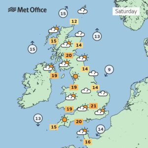
The United Kingdom faces a period of extreme weather contrast over the coming days. Forecasters predict that southern England will experience the warmest temperatures of 2026 so far. Some areas could see the mercury rise above 20 degrees Celsius by midweek. This warm spell results from a plume of mild air moving north from the continent.
Many residents in the south look forward to the first real taste of spring sunshine. Coastal resorts expect a surge in visitors as people take advantage of the unseasonable warmth. However, this pleasant outlook does not apply to the entire country. A powerful weather system named Storm Dave is currently gathering strength over the Atlantic.
The Met Office issued several yellow weather warnings for wind and rain across Scotland and Northern Ireland. These regions should prepare for gusts exceeding 70 miles per hour in exposed coastal areas. Heavy rainfall may lead to localized flooding and difficult driving conditions on major roads. Travel disruptions are likely for rail and ferry passengers in the north.
This atmospheric tug-of-war creates a clear geographic split in the nation’s weather. While Londoners enjoy outdoor dining, residents in the Highlands may face blizzard conditions on higher ground. The interaction between the warm air and the storm front will likely trigger thunderstorms in the Midlands. These storms could bring sudden downpours and lightning strikes during the evening commute.
Environment Agency officials are monitoring river levels closely in northern catchments. They warned that the combination of heavy rain and melting snow could cause water levels to rise rapidly. Residents in flood-prone areas should remain vigilant and check for the latest local updates. The storm is expected to move across the North Sea by Friday morning.
Public health experts advised vulnerable people to stay hydrated during the warmer spells in the south. Sudden increases in temperature can affect those with underlying respiratory conditions. Meanwhile, emergency services in the north urged drivers to avoid unnecessary travel during peak wind periods. High-sided vehicles are particularly at risk on bridges and open motorways.
The extreme variation in conditions highlights the volatile nature of British springtime weather. Meteorologists suggest that these patterns are becoming more frequent as global climate systems shift. After the storm passes, temperatures across the country will likely return to more typical April averages. Until then, the public should prepare for rapidly changing environments.
National parks and mountain rescue teams issued warnings for those planning outdoor activities. The combination of high winds and poor visibility makes hill walking dangerous this week. Safety should remain the top priority for anyone venturing into remote areas. Always check the latest local forecast before starting any journey.