KEY POINTS
- Beijing is rapidly expanding its underwater surveillance network across the South China Sea and Pacific.
- Advanced sonar technology and autonomous drones are creating detailed maps of the strategic ocean floor.
- Military analysts warn these seafloor surveys provide critical navigational data for Chinese attack submarines.
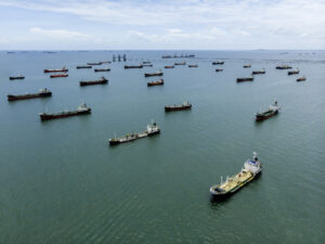
China has launched a massive initiative to map the deep ocean floor across vast areas of the Pacific. This scientific and military project focuses on identifying underwater terrain that can hide large submarine fleets. Recent reports indicate that Chinese research vessels are operating in waters previously dominated by the United States Navy.
The mapping effort uses sophisticated sonar systems to create high-resolution charts of the seafloor. These maps allow submarine commanders to navigate through deep canyons and mountain ranges without using active sonar. Staying silent is essential for avoiding detection by American surveillance networks during a potential conflict.
Chinese authorities claim these surveys are purely for civilian scientific research and resource exploration. However, the data collected has immense value for the People’s Liberation Army Navy. Understanding water temperature and salinity levels also helps submarines hide from enemy acoustic sensors.
The United States has long held a significant lead in underwater warfare technology and seafloor knowledge. Beijing is now working quickly to close this strategic gap through aggressive data collection. Many of these mapping missions take place near critical maritime chokepoints and undersea internet cables.
Autonomous underwater vehicles play a central role in this modern mapping strategy. These long-range drones can operate for months at a time while scanning the ocean floor. They send back massive amounts of data to central processing hubs located on the Chinese mainland.
Western intelligence agencies are monitoring the movements of Chinese survey ships with increasing concern. These vessels often operate near the territorial waters of U.S. allies like Japan and the Philippines. Such proximity allows China to map the exact routes American submarines take when leaving their bases.
The deep sea remains one of the last frontiers for military dominance in the modern era. China views the seafloor as a critical battlefield for future security in the Indo-Pacific region. By mastering the underwater environment, Beijing hopes to deter foreign intervention near its coastline.
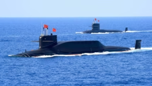
This expansion of maritime capabilities follows years of heavy investment in a modern blue-water navy. China now possesses more warships than any other nation, though the U.S. maintains more advanced nuclear submarines. Closing the information gap on seafloor geography is a top priority for Chinese military planners.
Satellite imagery shows that China is also building new facilities to support its growing underwater fleet. These bases feature reinforced tunnels and docks designed to protect submarines from aerial surveillance and strikes. The combination of better maps and protected bases strengthens China’s long-term maritime strategy.
The competition for underwater supremacy is reshaping the geopolitical landscape of the Pacific Ocean. Both superpowers are investing billions into new technologies to track and hunt submarines. The race to map the ocean floor is a quiet but vital part of this broader rivalry.